WeatherWise
Live Weather Radar Updates – Track Storms in Real-Time!
Weather radar systems send out radio waves from a radar station that bounce off objects like raindrops, snowflakes, or other particles in the atmosphere.
From tornadoes to hurricanes, thunderstorms to blizzards, live weather radar allows people to make informed decisions in moments of uncertainty. This comprehensive guide delves into the significance of live weather radar updates, how they work, and how you can leverage this technology to track storms and keep yourself and your family safe.
1. What is Live Weather Radar?
Weather radar is a system that uses radio waves to detect the movement and intensity of weather phenomena, particularly precipitation like rain, snow, or hail. Live weather radar updates allow users to see weather events as they unfold in real time, offering insights into storm systems’ location, intensity, and movement.
Unlike traditional weather forecasts that rely on estimates, radar provides instantaneous feedback, often updated every few minutes. This accuracy makes it one of the most valuable tools for anyone interested in tracking storms, especially those in areas prone to extreme weather events.
2. How Does Weather Radar Work?
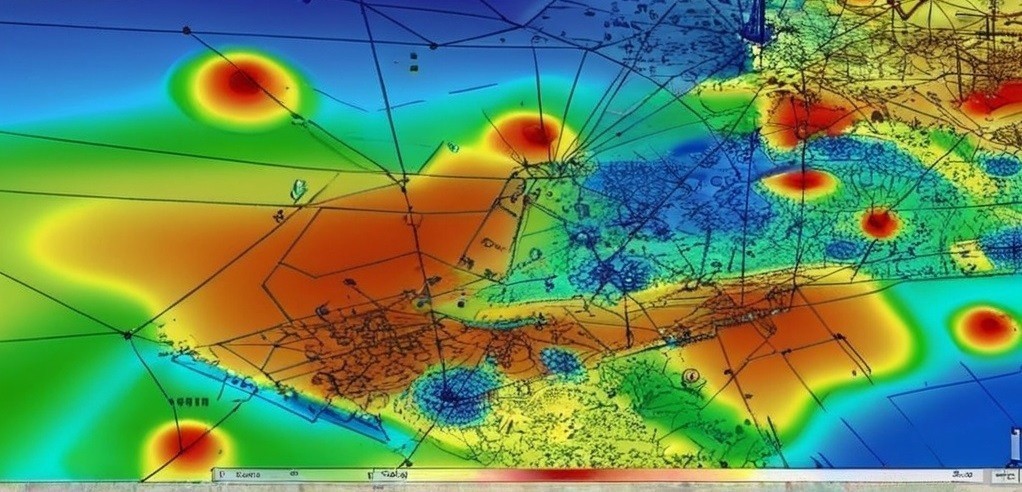
Weather radar systems send out radio waves from a radar station that bounce off objects like raindrops, snowflakes, or other particles in the atmosphere. The radar system then analyzes the return signal to determine the location, intensity, and speed of the storm or precipitation. The results are displayed on a map, showing various color-coded intensity levels.
- Doppler Radar: One of the most common types of weather radar, Doppler radar can measure not only the location and intensity of a storm but also its velocity (speed and direction). This is particularly useful for detecting rotation in storms, a key indicator of potential tornado formation.
- Dual-Pol Radar: An advanced radar technology that transmits and receives both horizontal and vertical signals, allowing for a more accurate analysis of precipitation type, intensity, and shape.
- Weather Radar Maps: These maps display radar data in a graphical format, showing a color-coded map of the storm’s intensity. Typically, green signifies light rain, yellow or orange for moderate rain, and red for heavy or severe storms.
3. The Importance of Live Weather Radar Updates
Real-time weather radar updates are essential for multiple reasons:
- Early Warning System for Severe Weather: By tracking storms in real time, weather radar can provide early warnings for dangerous weather events such as thunderstorms, tornadoes, and hurricanes. This is crucial for minimizing damage and loss of life.
- Increased Accuracy: Unlike traditional weather forecasting methods, which can often have a delay in providing information, radar gives near-instantaneous updates. It can help in predicting storm paths and durations more accurately.
- Enhanced Storm Tracking: Radar can help track the development of storms, pinpointing their exact location and movement. This allows residents to make timely evacuations or preparations before the storm arrives.
- Monitoring of Storms in Remote Areas: For areas that are difficult to reach or not covered by ground-based weather stations, radar provides crucial insights into storms and weather patterns.
4. How to Track Storms Using Live Weather Radar Updates
- Use Specialized Apps and Websites: Today, several apps and websites provide live weather radar updates for specific regions. Examples include the National Weather Service (NWS), Weather.com, AccuWeather, and Windy, all of which provide interactive radar maps. These platforms offer real-time data, forecasts, and alerts to keep users informed.
- Radar Layers and Features: Most radar apps offer various layers to enhance the accuracy of storm tracking. These layers include:
- Precipitation Radar: Shows rainfall, snowfall, and other forms of precipitation in real-time.
- Velocity Radar: Helps detect rotation and the movement of storms, which is crucial for identifying tornadoes.
- Severe Weather Alerts: Receive real-time alerts for severe weather warnings and advisories in your area.
- Customize Your Alerts: Set up notifications for specific weather conditions such as heavy rain, thunderstorms, or tornado warnings. This can give you more control over how you track storms and plan for them.
- Live Storm Tracking for Specific Events: Some advanced radar services provide live tracking for specific events like hurricanes. These platforms include highly detailed data like wind speed, storm surge forecasts, and storm intensity.
5. Key Features of Live Weather Radar Systems
- Real-Time Data Refresh: Most live radar updates occur at intervals of 2-10 minutes, providing users with the most current data available.
- Interactive Maps: Many radar platforms allow you to zoom in and out of specific areas, and some offer a 360-degree view of surrounding weather systems.
- Storm Motion Indicators: Real-time radar data includes arrows that indicate the direction and speed of a storm, giving users a clear idea of how quickly a storm is approaching.
- Severe Weather Warnings: Many radar systems will highlight areas where severe weather, such as tornadoes, severe thunderstorms, or flash floods, is currently affecting.
6. How Live Weather Radar Helps in Different Weather Scenarios
- Tornadoes: Doppler radar can detect rotation in thunderstorms, which is often an indicator of tornado formation. Radar systems issue tornado warnings when conditions are favorable for tornado development. The real-time nature of radar updates allows users to act swiftly, whether that means taking shelter or evacuating the area.
- Thunderstorms: For thunderstorms, radar updates allow you to monitor storm intensity. If the storm is accompanied by hail or heavy rainfall, radar will reflect this in real-time, helping you prepare for the storm’s impact.
- Hurricanes: Tracking hurricanes in real time is one of the most critical uses of weather radar. With live radar updates, you can monitor the storm’s progression, its wind speed, pressure, and potential landfall locations.
- Blizzards and Winter Storms: Radar can track snow and ice storms, including the rate of snowfall, which can help you prepare for the potential for hazardous road conditions or power outages.
7. Techniques to Maximize the Benefits of Live Weather Radar Updates
Stay Informed: Make it a habit to check live radar updates throughout the day, especially during severe weather seasons. This helps you stay ahead of storms and make timely decisions.
Use Multiple Sources: While one radar source may work for most situations, using a combination of different apps and websites gives you a fuller picture of the storm’s activity.
Take Advantage of Alerts: Set up your devices to receive weather alerts based on your location and the type of weather events you’re concerned about. Real-time notifications can make a big difference when preparing for an incoming storm.
8. Common Tips for Storm Safety During Severe Weather Events
Monitor the Radar for Changes: Sometimes storms can intensify or change direction rapidly. Monitoring the radar updates frequently will help you identify shifts in the storm’s path or strength.
- Have an Emergency Kit Ready: Always be prepared with an emergency kit that includes water, non-perishable food, flashlights, batteries, and other essential items. Your radar updates will give you the heads-up you need to stay prepared.
- Know Your Safe Place: Identify a safe place in your home (such as a basement or an interior room on the lowest level) where you can take shelter during severe weather.
- Stay Indoors During a Storm: If a storm is severe, stay indoors away from windows. If you are in a tornado-prone area, go to a small, windowless room at the lowest point in your home.
- Follow Evacuation Orders: If you live in a flood-prone area or a region threatened by hurricanes or wildfires, always follow evacuation orders promptly.
- Stay Informed and Be Ready to Act: Keep your mobile devices charged and have multiple ways to receive weather alerts, including through live radar systems, weather apps, and emergency broadcast systems.
Final Thoughts with Stats and Tips
Stats:
- According to the National Oceanic and Atmospheric Administration (NOAA), Doppler radar systems are capable of detecting a tornado’s rotation as far as 20-25 miles away from its formation.
- Live radar updates typically refresh every 2-10 minutes, offering almost real-time tracking.
- Storms can be tracked with radar systems 24/7, even in remote areas where traditional weather monitoring systems may not reach.
Tips:
- Set up your devices to receive automatic storm alerts for severe weather in your area.
- Use radar layering features to get the most detailed insights into storm movement, wind speed, and precipitation type.
- Monitor storm velocity and direction with live radar updates to stay ahead of severe weather.
- Stay informed about upcoming storms by checking radar updates regularly, especially during severe weather seasons.
- Create an emergency preparedness plan based on storm tracking data to reduce risk during severe weather events.
By utilizing live weather radar updates, you empower yourself with real-time data that can drastically improve your ability to respond to storms and adverse weather conditions.